Moulded by the Ice Age into a land of craggy peaks and deep valleys, Ireland is a hillwalker’s delight. From the 1000-metre-plus Carrauntouhill to the hundreds of smaller hills that dot the landscape, there is a mountain to suit every everyone. Below you will find information on some of Ireland’s most popular peaks.
The Mourne Mountains
Newcastle, Down
Described as relatively ‘young,’ the Mountains of Mourne were formed in the Ice Age more than 50 million years ago. Few areas of similar extent demonstrate such a variety of topography, landforms, coast forms, and human history or such bold contrasts of mountain, lowland and sea. The Mountains of Mourne really do ‘sweep down to the sea.’
Within a 25-mile circle, 12 summits rise to over 2,000 feet, including Northern Ireland’s highest mountain, Slieve Donard. The Mournes are unusual in that their summits are grouped together in a compact area only seven miles in breadth, so that the motorist is treated to a new panorama almost every mile.
No road traverses the central area (called ‘the wilderness’), making the Mournes perfect for the walker. This is also Northern Ireland’s favourite area for rock-climbing.
McGillycuddy Reeks - Carrauntoohill
Beaufort, Kerry
The McGillycuddy Reeks (also spelt the MacGillycuddy Reeks) include Ireland’s highest peak - Carrauntoohill - and form a breathtaking backdrop to the beautiful town of Killarney, stretching from the Lakes of Killarney along the middle of the Iveragh Peninsula.
Carrauntoohill is the central peak of the mountain range, attracting climbers from all over Ireland and beyond to climb this challenging mountain, which rises to 1,038 metres.
Inexperienced mountain climbers are advised not to climb the mountain without a knowledgeable guide.
Galty Vee Valley
Clogheen, Cahir, Tipperary
The Galty Vee Valley, with its ever changing vistas reflecting the variable hues of mountain, pasture and forest, lies in south Tipperary between the Galtys, Knockmealdown and Comeragh Mountains. To the east are the legendary Slievenamon and the Comeragh mountains, home of the Knock an Aifrinn ridge and many lakes, including Lake Coumshingaum, which is the largest corrie lake in the British Isles.
The Knockmealdown mountains, featuring the famous Vee Valley Pass, lie to the south. Here, a road built after the Great Famine of 1847 provides access to the coast and affords magnificent panoramic views of the mountains and plains of the Galty/Vee and the Blackwater valleys and the famous Cunnigar lagoon in Dungarvan. The Vee road is overlooked by the burial place of Samuel Grubb and leads to the secluded haven of the Cistercian monastery at Mount Melleray. The Galty Mountains to the north and the summit at Galtymore (3,018′) provide splendid views of the entire valley. Five glacial lakes nestle here, and the wooded slopes include Glengarra.
Lough Arrow Lough Gara Drive
Sligo
West of the village of Carrowkeel, at Castlebaldwin, a tar road gives way to a grassy track before a majestic cliff face. Parking is available at the apex of this track, and the short distance to the top of Bricklieve Mountain can be undertaken on foot. After rain the surface can be slippery, however, and the narrowness of the track leaves little room for error.
All but one of the cairns scattered over the hillside are passage graves; the other covers a court tomb. On a nearby ridge are what appear to be the remains of an ancient village. The commanding views of Sligo’s lakes are spectacularly beautiful.
Maamturk Mountains
Connemara, Galway
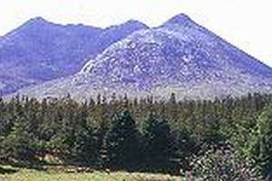
The Maamturks are an attractive range lying north-south overlooking Lough Inagh in County Galway. Like the Twleve Bens, they are quartzite peaks, and a trek of the entire range makes a fine day’s climb/walk.
Twelve Pins Mountains
Connemara, Galway
The Twelve Bens or Pins are the most inviting group of quartzite cones in Irelands. Despite their comparatively small height, they are proper mountains with cliff-bound ridges. They are mostly bare rock and scree-slope, and a circuit of any or all of the interlocking horseshoes requires a great deal of stamina. The chief peak, Benbaun, rises to 2,395 feet. A massive, if rather featureless, quartzite crag on Ben Corr is reached by some steep routes (up to 1000 feet) of all standards, characterized by small holds and lack of ledges and belays.
Croagh Patrick
Cloona, Westport, Mayo
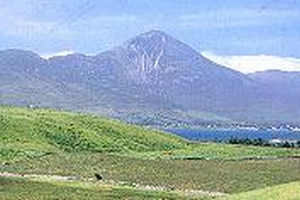
The sacred and beautiful Croagh Patrick is located about 8km from Westport on the Louisburgh Road. From most aspects, it rises from the sea on the southern shore of Clew Bay as a perfect cone to the height of 764 metres. There are larger and loftier masses of mountain in Ireland, but none so striking from its isolation. Croagh Patrick is a popular pilgrimage site for Roman Catholics, particularly on so-called Reeks Sunday.
Mount Errigal
Donegal, Donegal
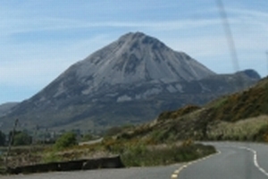
Mount Errigal is situated in the north-west of Donegal between Dunlewy, Gweedore, Gortahock and Glenveagh. A most distinctive and exciting mountain standing at over 752 metres, it is white in appearance and has a near perfect conical shape. The white appearance is a result of the extensive amounts of scree on the slopes.
Errigal dominates the landscape and valley, providing a dramatic backdrop to the shallow peat valley, subdivided by low dry stone walls. Errigal is steep and should be approached with care, particularly when descending, but the views are truly breathtaking on every side. Access to the uppermost peak is via a narrow goat track where the ground falls away sharply on either side. Those with a poor head for heights should stick to the lower ridge. The summit ridge offers views over Glenveagh National Park, the Poison Glen, and on a clear day Tory Island, off the north west coast.
