With its miles of unspoilt countryside, Ireland is the ideal country for the enthusiastic walker. Whether you are a laid-back rambler or a committed hiker, there is a walk suitable for you. See below for details of some of our favourites.
The Western Way Galway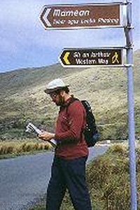
Camp Street, Connemara, Oughterard, Galway
This route starts at Oughterard and follows the shore of Lough Corrib to Maam. From Maam it finds a low level way through the great quartzite ranges of the Maum Turks and Twelve Bens, before descending to the deep, narrow valley of Killary Harbour and junction with the western Way (Mayo) near Leenaun.
Route Details:
Oughertard, Maam, Maumeen, Inagh, Toorenacoona, Leenaun.
Total Distance: 50km/31 miles.
Longest Stage: Maam to Toorenacoona - 18 km/11 miles (plus 5km/3 miles off route to nearest accommodation).
Highest Point: Maumeen - 259m/850ft.
Hotels in Galway can be booked from GoIreland.com, should you wish to reserve accommodation.
The Wicklow Way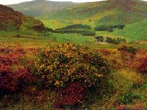
Glendalough, Wicklow
Launched in 1981, the Wicklow Way was the first long-distance walking route in the Republic. Called “Sli Cualann Nua” in Irish, after one of the five historic roads radiating from ancient Tara, the Wicklow Way runs for over 130 km from Marlay Park in Dublin southwards to Clonegal, County Carlow. Traversing the largest unbroken area of high ground in the country, the path passes through Laragh (1.5km from Glendalough). The Glendalough An Oige hostel is a frequent stopping point for travellers. Spectacular views to the north as far as Wales can be enjoyed on clear days. Skirting spectacular mountain ridges and peaceful glens and valleys, the Wicklow Way offers one of the most enjoyable ways of experiencing the beauty, serenity and tranquillity of Wicklow, Ireland’s Garden County. Check out a wide range of Wicklow hotels if you need to book accommodation.
Nire & Comeragh Guided Walks
Deerpark, Ballymacarbry, Waterford
Nestling in the Comeraghs, the Nire Valley is the ideal base for the walker wishing to explore these solitary and dramatic mountains. The Nire runs eastward from the village of Ballymacarbry and merges into the Comeragh Mountains under the “Gap”. This is the Gap through which we recommend the delightful low-level mountain walk from Knockanaffrin to Rathgormack. The name “Nire Valley” comes from the Gaelic “Gleann na hUidhre” which means the Glen or Valley of the Yellow/Brown stone which is to be seen along the river bank. The Nire River tumbles down through the valley from its source high up in the Comeragh mountain valley to the smooth flowing Suir River near Newcastle. The Irish language was the spoken tongue here until the early part of this century and to this day many of the old Gaelic phrases and customs survive in everyday life.
Kerry Way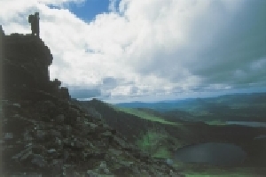
Killarney, Kerry
Stage 1: Killarney - Black Valley 22km (14 miles):
The route passes Muckross Friary, founded in 1448, and Muckross house built in 1843. Muckross house is now a folk museum. Another noteworthy sight is that of Torc waterfall, which cascades down Torc Mountain.
Stage 2. Black Valley - Glenbeigh 13km (8 miles):
The Black Valley was one of the last places in Ireland supplied with electricity and still offers splendid isolation.
Views can be had of Ireland’s highest mountain, Carrantuohill which is 3414ft. (1039m) in height. Other attractive features of this section are Lough Acoose and on a clear day, views of Killorglin and Dingle Bay.
Stage 3. Glencar - Glenbeigh 13 km (8 miles):
Glencar is an area shrouded in folklore and legend and the main theme of these legends was an army called the Fianna, who served the High Kings of Ireland.
There are many spectacular sights on this section of the walk, the Caragh River which is a famous salmon river, flowing into the famous Caragh Lake.
The Blackwater Way
Millstreet, Cork
The Blackwater Way comprises two sections: Avondhu and Duhallow. This varied trail includes the lower slopes of the Knockmealdown Mountains. It drops through the green lanes and boreens of sparsely populated hill farms to the historic settlements and rich farm and woodland of the Balckwater Valley.
It rises again onto the slopes of the Nagle Hills, where there are superb views over the Munster Plains, then to Shrone, just north of the Paps Mountains, which offers a contrast of wild bog, mountain, forest roadways, glens, lakes, rivers and stretches of beautiful isolation. The area abounds in wildlife and wildflowers in their season.
Route Details: Cloghen, Araglin, Kilworth, Fermoy, Killavullan, Mallow, Ballinamona, Bweeng, Nad, Millstreet, Ballydaly and shrone.
Total Distance: 168km/104 miles. Longest Stage: Nad to Millstreet - 30km/19 miles. Highest Point: Knockclugga - 570m 1868ft - alternate route marked for poor weather.
The Sheep’s Head Way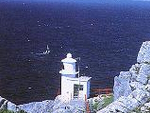
Bantry, Cork
The Sheep’s Head Way encompasses the Sheep’s Head peninsula and the greater Bantry area in West Cork. Starting in the Square, Bantry, it heads west on the northern (Bantry Bay) side of the peninsula, all the way to Sheep’s Head, and then back east to Bantry on the southern side (Dunmanus Bay) of the peninsula via Kilcrohane, Ahakista and Durrus.
During most of the Sheep’s Head Way the walker will have spectacular views of Bantry and Dunmanus Bays; sometimes both at the same time.
There are many historical/archaelogical monuments encountered along the way, and, in keeping with the special beauty of the peninsula, only stone and oak way-markers have been used.
Route Details: Bantry, Glenlough, Kilcrohane, Ahakista, Durrus. Total Distance: 88km/55 miles. Longest Stage: Finn MacCool’s Seat to Turning Table, Tooreen, Kilcrohane - 16km/10 miles. Highest Point: Gouladoo - 328m/1111ft.
If you are looking for accommodation, check out GoIreland’s range of hotels in Bantry with immediate confirmation on all reservations.
The East-Munster Way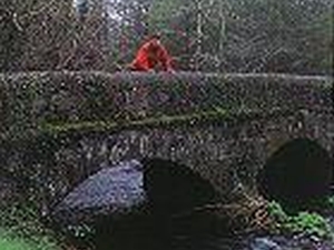
Carrick-on-Suir, North_Tipperary
The East Munster Way stretches from Carrick-on-suir to Clogheen, both in Co. Tipperary. The first section of the Way, from Carrick-on-suir to Clonmel, follows an old tow path of the River Suir through Kilsheelan Wood, presenting a host of scenic views around the famed Nire Valley.
Between Clonmel and Clogheen, the Way ascends through the picturesque village of Newcastle along the forested flanks of the Comeragh and Knockmealdown Mountains, rich with a variety of flora and fauna. It links with the Wicklow, South Leinster and Blackwater Ways, forming part of a 500km way-marked route from Dublin to Killarney. Route Details: Carrick-on-Suir, Kilsheelan, Clonmel, Newcastle, Clogheen. Totla Distance: 70km/43 miles. Longest Stage: Newcastle to Clogheen - 22km/14 miles. Highest point: Holy Year Cross, Glenary - 350m/1150ft.
The Cavan Way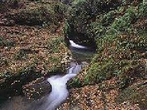
Cavan, Cavan
The Cavan Way provides a pleasant hill and valley walking connection between the Leitrim Way at Dowra, a small village community near the source of the River Shannon and the Ulster Way at Blacklion village.
Generally following the course of the young river to its source at the mystical Shannon ‘Pot,’ the walk follows quiet valley and riverside landscapes to the more open uplands of the spring line of the river’s source.
The walker will enjoy the upland section between the ‘Pot’ and Blacklion, which includes the forested Burren area and its cemetery of ancient tombs, stone megaliths and monuments. Fine views are available from these elevated upland areas. For accommodation options, check out GoIreland’s Cavan hotels which lists properties to suit all budgets.
Route Details: Dowra, Shannon Pot, Blacklion. Total Distance: 26km/16 miles. Longest Stage: Dowra to Blacklion - 26km/16 miles. Highest Point: Giant’s Grave - 260m/850ft.
Dingle Way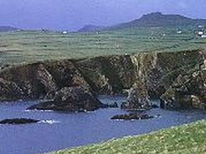
Tralee, Kerry
Stage 1. Tralee to Camp 17km (10 miles): The first stage of the Dingle Way starts in Tralee town. Further on along this route you pass near the ruins of Killelton Church and Graveyard. (Cill Eilthin, the chur
ch of Elton, said to be the nephew of St. David of Wales).
Stage 2. Camp to Annascaul 17km (10 miles): Along this route there are views of the Caherconree Mountain, which is home to an inland promontory fort. The route will take you into Annascaul village, a picturesque village bordering a lake, in a striking boulder-scattered coum.
Stage 3. Annascaul - Dingle 19km (12 miles): This section passes Minard Castle, and the ruins of Cahernanackree (Caher na Acrai, the stone fort of acres). There are remains of forts as well as bronze age field systems along the route.
Stage 4. Dingle - Dunquin 24km (14 miles): The next stage takes you west of Dingle town. Crossing over Milltown Bridge, in Burnham Wood is Colaiste Ide, the former home of the Lords of Ventry. This whole peninsula has over 1000 archaeological sites. Should you wish to reserve accommodation, check out GoIreland’s range of Dingle hotels and bed and breakfasts on offer for all budgets.
The Royal Canal Way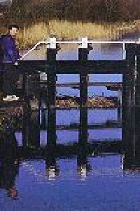
Waterways Service, Duchas The Heritage Service, 17/19 Lower Hatch Street, Dublin 2, Dublin
The Royal Canal Way will eventually link Dublin with the River Shannon at Clondra in Co Longford along the towpath of the Royal Canal. The Royal canal was closed in 1960, and the towpath and the channel both became overgrown, but today they are being restored for recreation, including walking.
Being a canal bank walk, the gradient is never steep, making it an ideal introduction to long distance walking. The Royal Canal Way currently follows grassy towpaths, gravel and sometimes tarmac canal-side roads from the Dublin suburb of Ashtown 105 kilometres to the village of Abbeyshrule in County Longford. Some sections of the path can be muddy. GoIreland.com offers a wide range of hotels in Dublin should you wish to reserve accommodation.
